June 9
The day after hiking what we could of the Taylor Creek Trail, we headed back up the same road to hike the Briggs Creek Trail. The two trails were in almost the same condition – near total disrepair – meaning we spent as much time clearing as hiking.
We began our journey at the Sam Brown Horse Campground, which was pretty cool place as each campsite had its own horse pen. You can camp right next to your horse.

We took the Dutchy Creek Trail up to the next campground where we started our hike on the Briggs Creek Trail. That trail starts off rolling through some pretty lush forests, containing some pretty impressive pine and fir trees.

“Lush” quickly turned to “overgrown,” and portions of the trail were not even visible. We had to hack and clip back brush in order to move forward and to make the trail an actual trail.

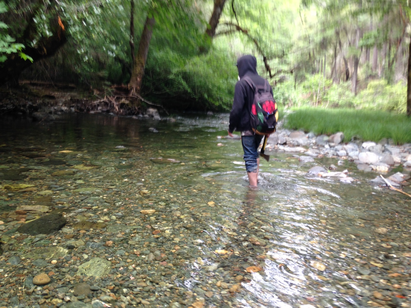
The first of about five creeks were missing their bridges, so we had to hike through the water.
In addition to the bridges being out and trails being overgrown, many of the signs had fallen down or were just plain unreadable.

If that wasn’t bad enough, there were countless logs that we had to climb over along the way. (Those that were too big for the axes we were carrying with us.) Some were easy to climb over, while others were not.

I was on “small branch duty,” while the kid had the axe and was on duty to tackle the medium-sized obstacles.

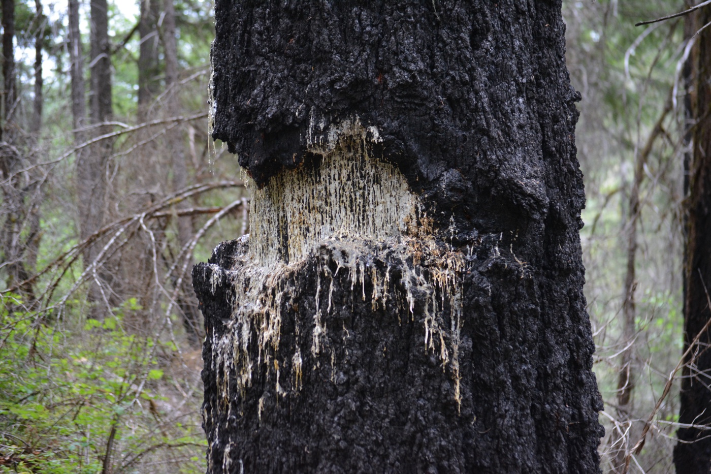
In fairness, a large portion of the destruction of the area was due to fire damage not just to negligence, as the trail moved through the dense forest and into a burn area.

The trail wove in and out of burn areas, following along Briggs Creek. I was really impressed with some of the trees’ ability to burn yet stay alive. Some of them were obviously more distressed than others, as they’d taken a pretty huge amount of abuse. But they still keep growing.
Briggs Creek is beautiful: lot of personality with unique plant life, tucked-away swimming holes, amazing rock formations, creating some impressive waterfalls and flows.

The creek was full of mining claims, one of the reasons why we’d decided to hike the trail. But unfortunately none of the claims had large enough openings to fly the drone, and even if we could, there was really not much more than yet-another-nature-photo opportunity.

Shortly after the seven mile mark on the hike we came to a pretty impressive watering hole, with a sign in front of it that pointed us downstream to continue the trail.

This is where we lost the trail. All I saw was river and a landslide from the hill where I assume the trail used to be. I walked a little farther downstream, but I could not find where the trail continued.

Honestly I was surprised the trail made it as far as it did, as it was so overgrown and as all the bridges were out. I managed to do a drone flight where we terminated the hike, so by that measure the trip was a success.
But now, we just needed to hike the seven miles back. At least we didn’t have to do as much trail work as we did hiking in. When finally did get back to the car, we were beat! The kid said, “I’m sure underneath all this pain, there is a sense of accomplishment.””
Both Taylor Creek and Briggs Creek really make me want to do something about the condition these trails are in. Every single trail we hike has a significant amount of damage – some from fire, some from winter, but most of it just comes from neglect.
The hike was beautiful and challenging, and a success in my opinion, even through we didn’t see any significant drone flight opportunities along the way. The trail demonstrated to me how much the kid responds to being pushed on the trail – something that will continue to set the tone for our summer.
(Check out the rest of the photos, as well as the little bit of drone footage we shot on this hike.)