June 6
We had tried to hike to Bolan Lake lookout when we first landed in Oregon a couple weeks back, but we hit snow on the road that was deeper than I dared drive through with a low clearance Subaru. So after a couple weeks of hot weather, I figured it was a good time to head back up the mountains and to see if we could get up to the top of the Bolan Peak.

We parked at the lake early in the morning, and after scoping out the campground, we saw there was only one other truck parked there. It was the first time we wanted to fly the drone with anyone else around, so I went over to ask if flying the drone would be an issue. An older gentleman was there with his granddaughter and his hunting hounds, and after I told him what we were up to, he said it would be fine with him if we flew the drone.

I got to work unpacking the drone, and preparing for takeoff. The kid took the controls and began shooting the lake and surrounding meadows from this lower vantage point. The man drove off in his truck, but then he circled back around the loop and parked. He was interested in seeing the drone in action.

After we were done filming, we packed up the drone. We grabbed our backpacks and began hiking up the trail to the top of the mountain. At first the trail was of moderate difficulty, with switchbacks leading up into the high altitude forest. In fairly short order, we came across our first patch of snow, which was pretty sparse at first.

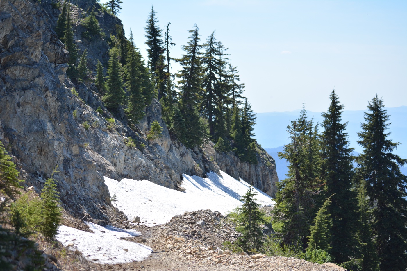
As we continued to the climb, we came across snow patches more frequently. Many of these also had a slightly dangerous element insofar as they had these hollow spots underneath them where the melting snow was running down the trail.

As we climbed higher, the trail continued to narrow, and the cliff to our left continued to grow steeper. We were hiking on the north side of the hill at this point, so the snow patches continued to get deeper and wider as well.

Eventually we started questioning the safety of the hike: would we be able to make it across some of these? We were forced to crawl on all fours to make it across some of the patches, working hard to not slide down the eighty foot drop-off to the rocks below. Even trickier when holding the drone case in one hand.

Luckily we made it off the north side of the mountain trail and into a spot with a little more southerly exposure. So while the trail got steeper and rockier, at least there were no big snow patches to traverse.
It is a pretty strange feeling to be crawling across snow, with your hands and knees frozen, but the rest of your body overheating and sweaty in the June sunshine. You’d think the snow would be a cooling relief from that sun, but it is actually pretty painful.

Like every other trail we’ve hiked, the Bolan Peak Trail is in pretty poor condition. In addition to the snow, there are big trees lying across the trail and plenty of branches and limbs to clear. At one point, we came to a fork in the trail, and the sign was laying face down in the path, so the kid quickly got to work propping it back up with a base of rocks.

After a couple miles of hiking, we finally made it to the top of the mountain, and as we rounded the bend on the trail, the fire lookout came into view. It is still early in the season so the lookout is boarded up, but we made good use of the deck, as well as the shade created by the lookout on what had become quite a hot day.

We unpacked the drone and prepared for a flight around the top of the mountain, giving us a much more elevated perspective of Bolan Lake than we were able to capture from below earlier that day.

The views from up top are just amazing. You have a 360 degree view of the valleys and mountains, spanning both Oregon and California. “You can’t help but feel more grounded being up here,” the kid said. Success.

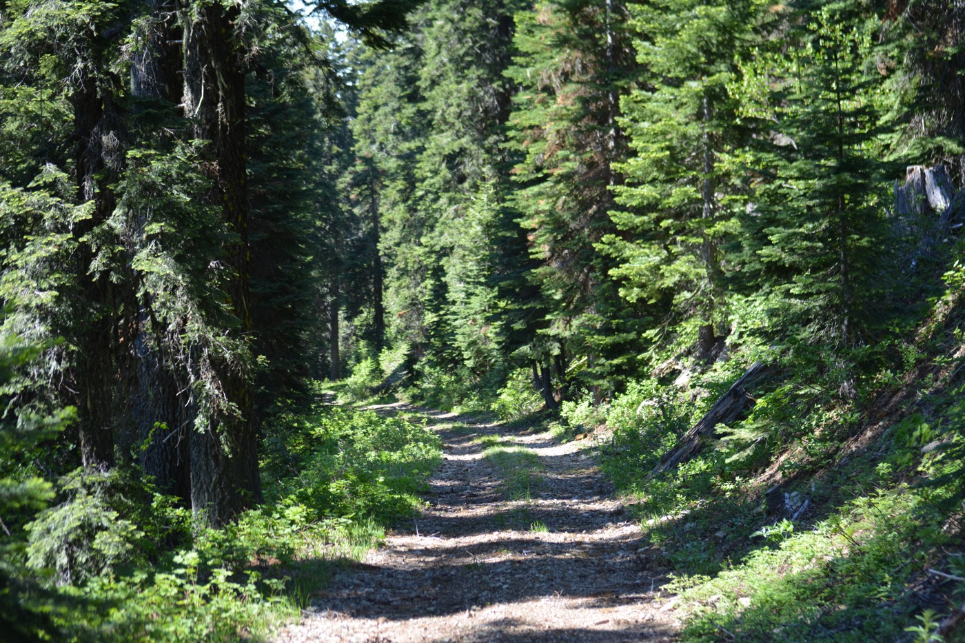
As we headed back down the mountain, we took the fire lookout access road, which is longer but (potentially) easier than the trail. The road wasn’t without snow to climb over and around, and we questioned our decision to go this way as we made our descent.
The road led us through some pretty lush mountain forests, and eventually we didn’t have to climb over any more snow. But it was definitely longer than the trail, and it us a couple of hours to make it back to the car.
I believe we did about six miles total that day, so we took the chance to rest by lake and enjoy a lunch break. Like some of our other southern Oregon hikes, Bolan Lake was rich with wildflowers. I’m really beginning to enjoy taking pictures of their diversity.


Bolan Lake, Bolan Peak, and its lookout provided us with another successful hike. Here, we accomplished multiple drone flights, capturing some stunningly beautiful landscapeon film. The feeling at the top of the mountain was a bonus, and the response from the kid showed me that this is all working. The trail invigorated him. He took pride in standing the trail sign back up, and he acknowledged the healing effect this project is having on him.
By the end of the day, we were once again dead tired, and we headed back down the river to setup camp along the Illinois River, wrapping up a pretty amazing day at Bolan Lake.
